
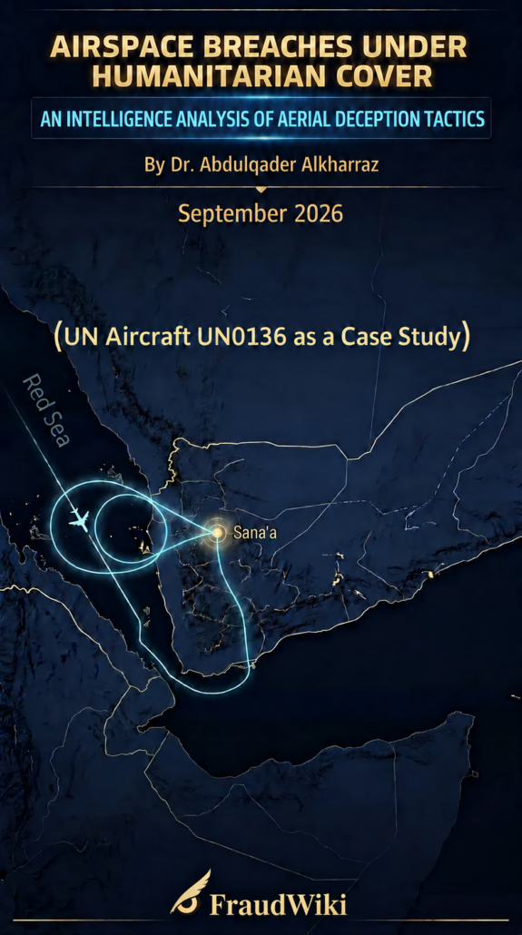
Report: Airspace Intrusion and Humanitarian Cover: Intelligence Monitoring and Analysis of Aerial Deception Tactics over Yemen
(UN aircraft UNO136H as a case study)
Prepared by: Dr. Abdulqader Alkharraz
FraudWiki – 18 September 2026
Executive Summary
This comparative analytical report identifies a recurring pattern of aerial deception and manipulation of air navigation in Yemeni airspace. The pattern involves the intersection and timing of unscheduled flights operated by humanitarian organisations, such as Médecins Sans Frontières (MSF) and the International Committee of the Red Cross (ICRC), with UN aircraft, including the aircraft using the call sign UNO136H, and gaps in radar tracking. This suggests that humanitarian cover may be used to shield unidentified flights or facilitate an undeclared incursion towards Sana’a International Airport, which is controlled by the Houthi militia. Field monitoring also recorded a large-scale security and military alert around Sana’a airport, along with convoy vehicles and ambulances whose sirens continued for more than an hour before and after the arrival of the two aircraft and after their departure.
These findings are of critical intelligence significance when linked to previously observed activity involving the same aircraft, UNO136H. On 24 August 2026, the aircraft was documented providing aviation cover for an unidentified stealth-type aircraft that landed at Sana’a airport. The findings also connect with the report titled “The Parallel Air Corridor”, previously published on FraudWiki.
First: Air Traffic at Sana’a Airport on 16 September 2026
Based on close field monitoring and tracking of Sana’a International Airport on Wednesday, 16 September 2026, the arrival and departure of two medium-sized aircraft were recorded under suspicious operating conditions. Neither aircraft appeared in the UN flight schedules published in September 2026 after publication had been suspended for a full year, since October 2025. Significant discrepancies were also observed in the flight data displayed on global tracking platforms, including Flightradar24, together with an apparent incursion attempt and attempted course change by a UN aircraft arriving from Jordan. See Table 1.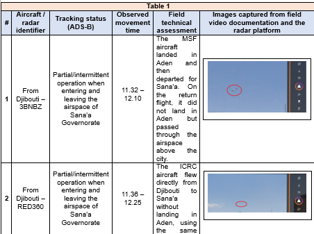
Second: Tactical and Intelligence Analysis of the Incident on 16 September 2026 (Attempted Deviation, Course Change and Incursion by UN Aircraft UNO136H)
- Critical Timing and Aerial Coordination
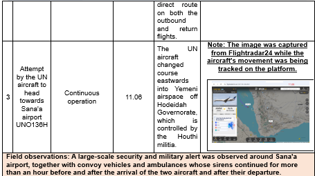
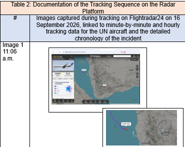
- 11:06 a.m.: Monitoring teams using radar platforms observed the UN aircraft UNO136H deviating from its flight path over the Red Sea. It turned eastwards into Yemeni airspace off the coast of Hodeidah Governorate (Image 1). At the same time, the ICRC and MSF aircraft appeared on radar heading towards Sana’a airport.
- 11:10 a.m.: UNO136H deviated eastwards and entered the Al-Khawbah area, north of Al-Salif in Hodeidah Governorate, which is controlled by the Houthi militia, heading towards Sana’a. This precisely timed movement preceded the landing of the MSF and ICRC aircraft at Sana’a airport: they approached between 11:17 and 11:26 a.m. and landed at 11:32 and 11:36 a.m.
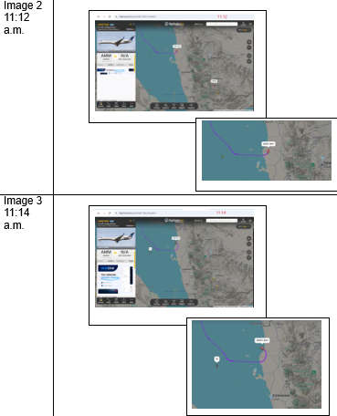
- 11:12 a.m.: The aircraft began reversing the detected incursion and eastward deviation. Radar also showed a military helicopter that had departed from Abha airport in Saudi Arabia that morning and was positioned along the maritime flight path (Image 2).
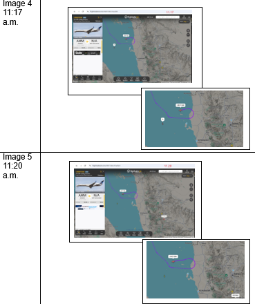
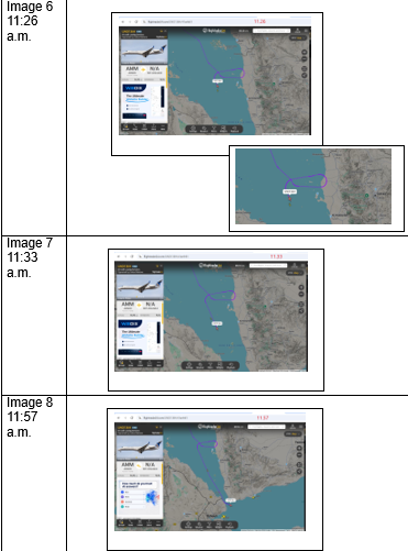
- Sudden withdrawal and reversal (11:14–11:17 a.m.): UNO136H made a sharp turn westwards towards the Red Sea and abandoned its unexpected deviation. There is a high likelihood that this reversal was a response to direct detection or an operational warning or intervention, supported by the presence of the military helicopter from Abha along the same maritime flight path (Images 3 and 4).
- 11:20 a.m.: UNO136H began returning to the maritime route from which it had deviated, heading towards Aden (Image 5). The military helicopter remained visible along the maritime route.
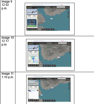
- 11:26 a.m.: UNO136H had fully returned to its maritime route. The military helicopter appeared beside the UN aircraft on a parallel track as the aircraft corrected its course (Image 6). At this point, the tracking signals of the ICRC and MSF aircraft also disappeared over Dhamar Governorate.
- 11:33–11:57 a.m.: The flight path of UNO136H was continuously monitored on the radar platform until it reached the airspace over the Bab al-Mandab Strait (Images 7 and 8).
- 12:02–12:17 p.m.: UNO136H was continuously tracked until it landed at Aden airport (Images 9 and 10). It remained there for approximately 48 minutes before departing for Jordan via the usual maritime route.
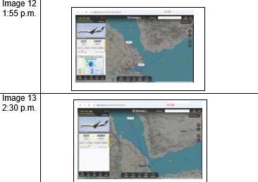
- 1:10–2:30 p.m.: The return route of UNO136H was continuously monitored until it left the airspace over Yemen’s territorial waters in the Red Sea, headed north into the airspace over Saudi territorial waters, and continued towards Jordan (Images 11, 12 and 13).
Table 2 documents the monitoring sequence using images captured from the radar platform.
- Operational Coordination of the Organisations
- The MSF aircraft first landed in Aden for apparent clearance or inspection before continuing to Sana’a.
- The ICRC aircraft bypassed Aden entirely and used a direct corridor from Djibouti to Sana’a. On the return journey, both aircraft bypassed Aden airport and continued towards Djibouti.
- Ground Security Indicators in Sana’a
- The intensive ground movements in Sanaa Airport, including ambulances and official convoys operating for more than an hour, may indicate a high-level medical evacuation or the transport of a senior figure or high-ranking foreign experts on one of the two aircraft operated by MSF or the ICRC. Medical flights provide a plausible justification for transporting critical cases without detailed identity checks.
Third: Analytical Comparison of the Incidents and Field Observations (Table 3)
| Table 3 | ||
| Comparison point | Incident of 24 August 2026 (previous FraudWiki report) | Incident of 16 September 2026 (field observations, radar-platform tracking and current tactics) |
| UN aircraft (UNO136H) | · Declared route: Jordan–Aden–Jordan.
· Deviation: Entered deep inland via Lahj, Al-Dhale, Ibb and Dhamar, reached the airspace over Sana’a, and then continued northwards. · Flight behaviour: Provided radar cover for an unidentified stealth-type aircraft that landed at Sana’a airport.
|
· Declared route: Jordan–Aden–Jordan.
· Deviation: Turned eastwards towards Al-Khawbah/Al-Salif in Hodeidah and headed towards Sana’a at 11:12 a.m., followed by a sudden turn westwards at 11:14 a.m. after an apparent signal or intervention to stop the incursion. · Flight behaviour: Attempted a rapid incursion and course change while two unscheduled aircraft operated by MSF and the ICRC were approaching Sana’a airport. · Possible intervention to prevent the incursion: The presence of the military helicopter is strongly assessed to have influenced the decision to halt the incursion towards Sana’a airport and make the sharp turn. Continuous surveillance may have been under way, and VHF/HF radio contact may have warned the aircraft, stopped the deviation and compelled it to return to its normal route. |
Fourth: Link to Findings Previously Reported by FraudWiki
- Recurring pattern of conduct: A report issued on 26 August 2026 by the #We_Will_Not_Remain_Silent campaign, led by Dr. Abdulqader Alkharraz and published on FraudWiki, established that UNO136H had previously been used on 24 August in an aerial deception operation. It flew deep into Yemeni governorates to confuse radar systems and mislead tracking platforms while unidentified stealth-type aircraft landed at Sana’a airport.
- Tactical adjustment: After the earlier operation was exposed and its tracking report published, the operators changed tactics on 16 September 2026. They attempted to enter from the western coastal area, through Hodeidah/Al-Khawbah, rather than deviating from the south through Lahj/Al-Dhale. Early detection, together with the likely presence of military monitoring or a direct warning by radar or airborne communication involving the helicopter, prevented the incursion from being completed. The aircraft quickly returned to the usual maritime route and continued to Aden.
Fifth: Risk Matrix and Conclusions
- Misuse of UN and humanitarian cover: The repeated use of the call sign UNO136H and the provision of cover for unscheduled organisational flights indicate the existence of a “parallel air corridor” used to circumvent the procedures of the Coalition and the internationally recognised government.
- High-level smuggling: This flight and field activity creates critical risks, including the transport of experts, the smuggling of sensitive technical equipment, or the movement of funds and senior leaders.
- Djibouti–Sana’a vulnerability: Direct flights from Djibouti to Sana’a that bypass inspection in Aden or other government-controlled entry points create a blind spot (Black Hole) that is exploited repeatedly.
Sixth: Strategic Recommendations
- Mandatory transparent tracking (ADS-B): Prohibit the operation of any UN or organisational aircraft if its tracking equipment is switched off or if the declared flight-plan data are manipulated.
- Mandatory landing in Aden: Require every flight operated by an organisation, including the ICRC and MSF, to stop at Aden International Airport for thorough inspection on both outbound and return journeys. End the exemption allowing direct passage from Djibouti. Given the current wartime conditions, all UN and other organisational flights to Sanaa Airport should also be suspended for one month.
- Submit a formal breach memorandum: Provide the current radar records and the comparison with the previous FraudWiki report to the relevant international bodies and monitoring cell, and request an official UN explanation of the suspicious use of the call sign UNO136H.
- Integrate aerial and ground monitoring: Maintain coordination between the campaign’s field-monitoring teams, aerial-surveillance assets and the relevant authorities to prevent any new deception attempts.
References
- Report: The United Nations Resumes Publishing Flight Schedules to Sana’a after a One-Year Suspension, 2 September 2026, FraudWiki
- Report: Analytical Tracking of Air Traffic at Sana’a Airport—Documentation of the UN Aerial Deception Operation on 24 August 2026 and Analysis of the Immediate Risks, 26 August 2026, FraudWiki
- Abdulqader Alkharraz’s pages on Facebook and X (formerly Twitter)
- Flightradar24 flight-tracking platform and the route link for UN aircraft UNO136H
https://www.flightradar24.com/data/aircraft/n18101#41aefe61
- Report: The Parallel Air Corridor—A Security Threat and Misuse of Humanitarian Cover, November 2025, FraudWiki
The report PDF
Airspace_Intrusion_and_Humanitarian_Cover_Intelligence_Analysis_EN - with cover
